Hazel Creek

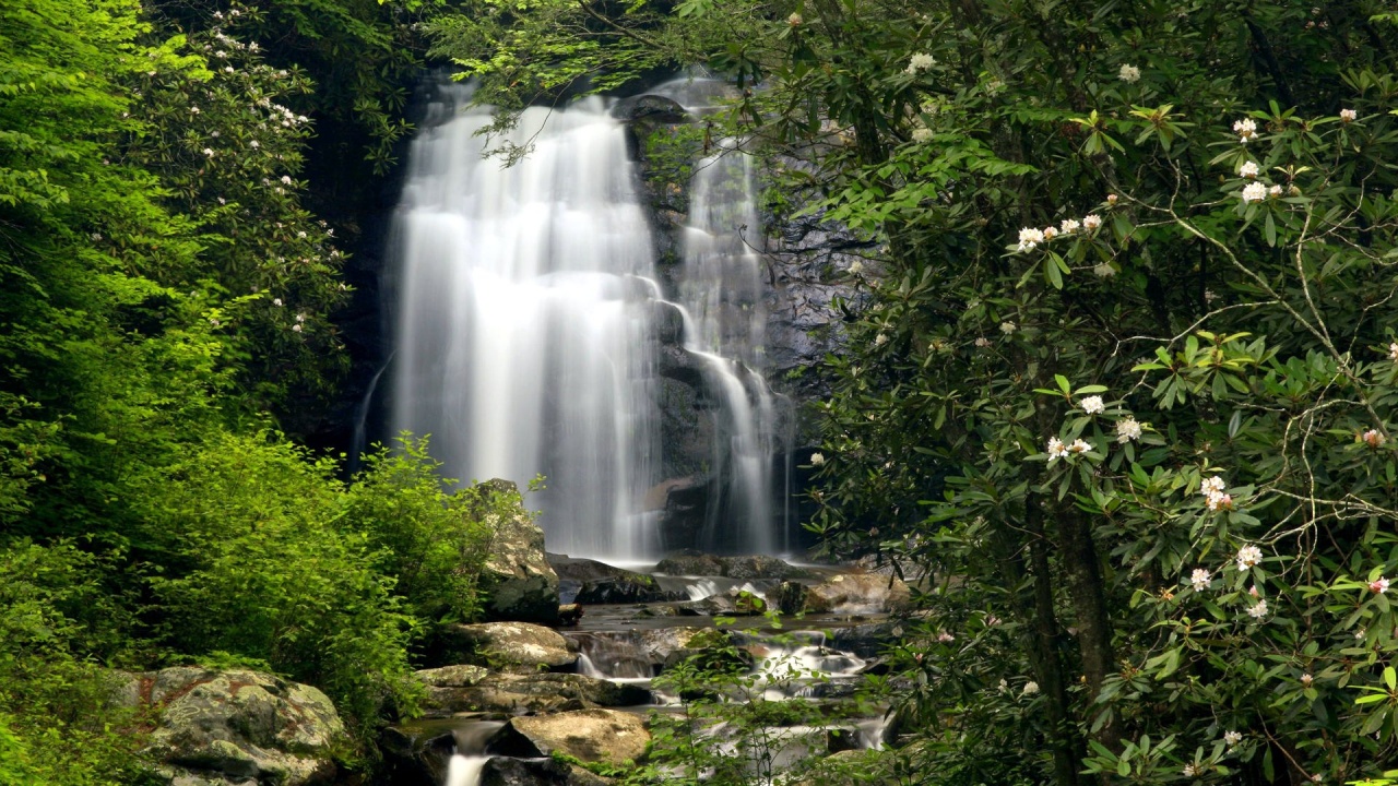
If you’re coming to the Sevierville area this year and plan on spending most of your time here in the great outdoors, it’s likely that you’re one of the many people who enjoy fishing the waters of the Great Smoky Mountains. Around here, one of those bodies that numerous anglers seek out is Hazel Creek, located at the southern end of the Great Smoky Mountains National Park.

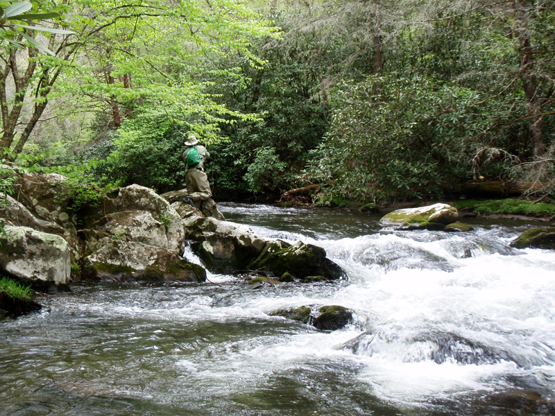
For fishermen, it’s almost like killing two birds with one stone. Not only are there ample opportunities to catch some beautiful Smoky Mountain trout on Hazel Creek, small-mouth are also said to populate this area.

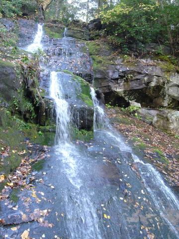
A tributary of the Little Tennessee River, Hazel Creek is found in the southwest portion of the Great Smoky Mountains and is also home to a few backcountry campsites. It’s one of the larger streams in the park and can be accessed from the Hazel Creek Trail – a 14.7 mile hike found at the site of the old town of Proctor.

But enough with the history lesson, etc., what about the fish? There is plenty brown and rainbow trout in this Smoky Mountain creek. Brook can be found in the headwaters, but those are catch and release only. From a casting standpoint, Hazel Creek is not difficult at all and there is plenty of room.

Many regard Hazel Creek as one of the best, if not THE best, streams for trout fishing in the national park. This is partly due to the food supply – Hazel Creek has a large supply of aquatic insects of different genus and species for the trout to eat like Caddis flies and mayflies. The Hazel Creek valley was also once home to several mountain families, as well as a large lumber company at one point. This damaged the stream in many ways but also, at least from a few standpoints, improved the stream insofar as its ability to support non-native species of fish.

The lower reaches of Hazel Creek not only hold trout, but healthy populations of largemouth, smallmouth, and rock bass. This is one of the very few places in the Great Smoky Mountains National Park where largemouth bass can be caught by fly fishermen.

Crossing the lake by boat is perhaps the easiest and most popular way to visit Hazel Creek. For a modest sum, the operators of the Fontana Village Resort Marina provide transportation across the lake by arrangement.

Meigs Falls

One of the lesser known and far less traveled trails to a Smoky Mountain waterfall is the Meigs Falls trail just outside Sevierville on the way to Gatlinburg.

To reach the falls, take the Meigs Creek Trail, which is located 11.4 miles west of the Sugarlands Visitor Center, just outside Gatlinburg in Great Smoky Mountains National Park. The bottom of the falls is actually a great place during the spring and summer months for swimming and cooling off on a hot day.

Don’t judge the area by the parking lot. While it does stay busy and, the Meigs Creek Trail to Upper Meigs Falls is one of the less traversed. Most people use the lot to park and walk to other trails or points of interest in the area.

Just below the confluence of Curry Prong, Henderson Prong, Bunch Prong, and Bloody Branch on Meigs Creek you’ll find Upper Meigs Falls. It’s a 15-foot cascade into a small pool shaded by thick rhododendron and a hardwood forest. You must climb two hills on the way there, which makes it a moderately difficult hike.

The trail drops from The Sinks viewing area into a quiet forest and begins the first of two climbs. Look for bear in the thin understory of this second-growth cove. The trail climbs steadily west to a hairpin at .7 miles, where it turns sharply east and crests with views of Lumber Ridge and Meigs Mountain.

Note white pine, table mountain pitch, and various oak in this Pine Oak forest, a contrast to the poplar, tulip, and maple that dominated the north-facing slope just behind you.

The trail drops into a narrow valley and crosses three consecutive streams on the ravine floor. Maintain navigational vigilance on these sparingly marked crossings and through this notably cluttered forest. After the crossings the trail turns up beside Meigs Creek, where you’ll soon see Upper Meigs Falls through a small chute on your right. Scramble down to reach the falls and drop pool.

The falls spill down a slick rock face into a small pool ringed by boulders and debris. Space is limited, but there’s enough room to maneuver for additional perspective and look for salamanders, which are abundant in this area. The Meigs Creek Trail continues for 2 miles up to Buckhorn Gap at the Lumber Ridge Trail junction.

Hiking the Smokies – Hen Wallow Falls

The hike to Hen Wallow Falls is moderate but very rewarding at the end. The falls descend 90 feet to a pool below.

Just a short trip east along Interstate 40 is Cosby, TN, where you’ll find the hike to Hen Wallow Falls. It’s a short day trip from Sevierville that takes about a hour to reach the trailhead which is found just past the entrance to the Great Smoky Mountains National Park on the Cosby side. From there it’s a 4.4 mile roundtrip to the the falls but totally worth it if you’re a fan of the Smokies and its natural beauty.

The trail itself can be steep and rugged to start out with but you’ll eventually pass through a growth of hemlock and rhododendron. Rock Creek will eventually come up on your right, and you’ll pass signage for a trail that leads to the Cosby Campground before crossing over Rock Creek.

Continuing on from the trailhead about a mile you’ll reach Messer Gap. Expect you see various other offshoots along the trail but keep on as you’ll eventually come to what was an old rock wall on the left of the trail. Most likely this was at one time a homestead.

A signed side trail at 2.1 miles leads to the base of the 90-foot Hen Wallow Falls by way of steep switchbacks. Hen Wallow Creek, which was only two feet wide at the top of the falls, dramatically transforms into a 20 foot falls at the base. In all, Hen Wallow Falls descends 90 feet from its small creek beginnings.

*Just a note, for some great winter photographs visit the Hen Wallow Falls in January when it freezes into an icy cascade.

Access Trail: Gabes Mountain

Trailhead: Park at the Cosby Picnic Area – near the entrance to Cosby Campground. From there, walk back along the road to the Gabes Mountain Trail.

Etc.: The hike is generally considered moderate in difficulty. It takes about 3-4 hours to hike to the waterfall and back. Hikers continuing on the Gabes Mountain Trail beyond the falls can enjoy an old-growth forest. Pets and bicycles are prohibited on the trail. Hikers are also prohibited from climbing on the rocks around the waterfall. Over the years, several people have died from falling off the rocks and numerous others have suffered serious injuries from climbing on the rocks near the waterfall. Due to mist and algae, the rocks aligning Hen Wallow Falls are extremely slippery. Children should be supervised closely at all times.

Hiking the Smoky Mountains

Some tips for a great hike in the Smoky Mountains.

With fall foliage about to reach peak color in the Smokies, it’s about time you tied up those hiking boots one last time this year and hit the trail. Don’t ya think?

Hiking the Smoky Mountains is one of the best reasons to visit Sevierville, TN. Just look up from any spot, and you will see picturesque views of the Great Smoky Mountains enveloping you. Downtown Sevierville itself is just a few short miles away from the Great Smoky Mountains National Park, home to more than 800 miles of hiking trails, and plenty of opportunities for you and your family to get closer with nature.

A quick hiking tip: Pick up a hiking guide for the Great Smoky Mountains when you enter town at the Sevierville Visitor Center located at 3099 Winfield Dunn Parkway (1.5 miles from I-40 Exit 407). Best of all, all purchases at this gift shop, which is operated by Great Smoky Mountains Association, benefit the national park.

Most Popular Hiking Trails
Abrams Falls – 5 miles; 340′ climb; moderate: a relatively flat trail leading to the 20′ falls
Arch RockĀ  – 2.5 miles; 400′ climb; easy; trail leads to an erosion-created tunnel
Chimney Tops – 4 miles; 1,335′ climb; strenuous; winds through a virgin forest to the Chimney Top pinnacles
Hen Wallow Falls – 4 miles; 520′ climb; moderate; good, short day hike to 95′ falls
Sugarlands Valley Nature Trail – 3,000′ loop, paved trail with educational exhibits and communications media Continue reading “Hiking the Smoky Mountains”