One of the lesser known and far less traveled trails to a Smoky Mountain waterfall is the Meigs Falls trail just outside Sevierville on the way to Gatlinburg.
To reach the falls, take the Meigs Creek Trail, which is located 11.4 miles west of the Sugarlands Visitor Center, just outside Gatlinburg in Great Smoky Mountains National Park. The bottom of the falls is actually a great place during the spring and summer months for swimming and cooling off on a hot day.
Don’t judge the area by the parking lot. While it does stay busy and, the Meigs Creek Trail to Upper Meigs Falls is one of the less traversed. Most people use the lot to park and walk to other trails or points of interest in the area.
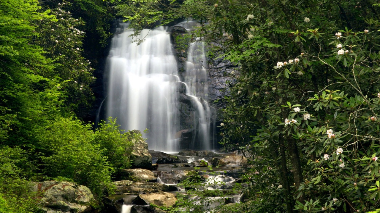
Just below the confluence of Curry Prong, Henderson Prong, Bunch Prong, and Bloody Branch on Meigs Creek you’ll find Upper Meigs Falls. It’s a 15-foot cascade into a small pool shaded by thick rhododendron and a hardwood forest. You must climb two hills on the way there, which makes it a moderately difficult hike.
The trail drops from The Sinks viewing area into a quiet forest and begins the first of two climbs. Look for bear in the thin understory of this second-growth cove. The trail climbs steadily west to a hairpin at .7 miles, where it turns sharply east and crests with views of Lumber Ridge and Meigs Mountain.
Note white pine, table mountain pitch, and various oak in this Pine Oak forest, a contrast to the poplar, tulip, and maple that dominated the north-facing slope just behind you.
The trail drops into a narrow valley and crosses three consecutive streams on the ravine floor. Maintain navigational vigilance on these sparingly marked crossings and through this notably cluttered forest. After the crossings the trail turns up beside Meigs Creek, where you’ll soon see Upper Meigs Falls through a small chute on your right. Scramble down to reach the falls and drop pool.
The falls spill down a slick rock face into a small pool ringed by boulders and debris. Space is limited, but there’s enough room to maneuver for additional perspective and look for salamanders, which are abundant in this area. The Meigs Creek Trail continues for 2 miles up to Buckhorn Gap at the Lumber Ridge Trail junction.